Going Past Colonialism Latitude: A Return to Point Zero

Yellow equatorial line: marking the geographical latitude of zero degrees, equatorial monument La Mitad del Mundo (middle of the world) in San Antonio de Pichincha, Ecuador, South America | Photo (detail): Guenter Fischer © picture alliance / imageBROKER
In Yvonne Owuor’s novel “The Dragonfly Sea”, a young Kenyan student ponders on the fact that she belongs, as a citizen of one of the 13 countries across which the Equator crosses, to “the centre of the world”. That geographical reality is contradicted by her every-day experiences as a foreign student, where she is constantly reminded of how little the immensity of the history, knowledge, wisdom, and experiences of her people mean in the geo-political global hierarchies of power.
This brings to mind the definition of “latitude” in Kiswahili – “mstari wa kidhahani” (literally: imaginary line) – and the way in which lines of latitude become real through the power of our collective imagination. “Latitude” brings to mind distance, in terms of measuring how far one departs away from a central point, and from other points away from it. Not only therefore do we have “North” as opposed to “South”, we also are able to imagine distances from a middle ground – point zero - represented by the Equator. Latitude also describes the immense possibilities of the imagination – the freedom (or lack thereof) to think, and therefore to act or to be. Finally, from the perspective that is the equator, latitude focuses our minds on what it means to be centred.These dimensions are, for me, at the core of the priorities of post-colonialism in this historical era; which I think about as the project of moving past colonialism. Moving past colonialism is about, as articulated below, expanding our imagination of the world to go beyond a world ordered in a hegemonic hierarchy; interrogating our perceptions and understandings of the familiar; and moving beyond unicentricity to a multiplicity of “point zeros”.
In Focus: Hierarchies and Hegemonies
Used in relation to maps, “latitude” is used to locate oneself in the world, and metaphorically and literally, to navigate the distance between that location and others. Historically, it facilitated and undergirded the conceptualisation of the contemporary era of globalisation that bifurcated the world into roles based on a global system of imperial conquest we call colonialism.-
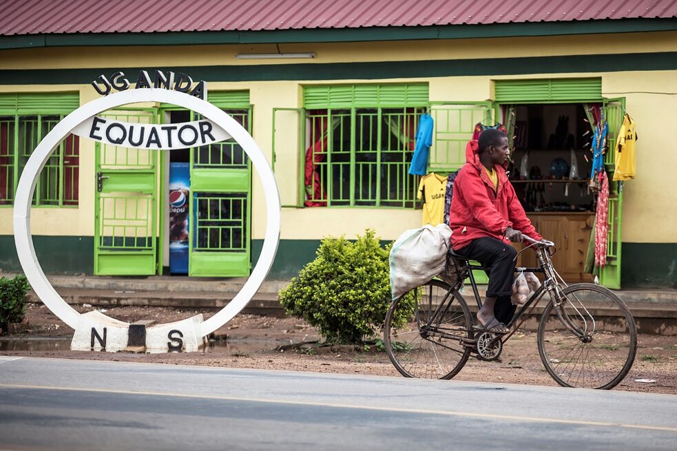
Latitude: At several points in Uganda there are tourist facilities and shops along the equator. The geographical line is even drawn on the currency of the African country. For many people, however, the road to the southern hemisphere is only a normal connection that can be travelled by bicycle. -
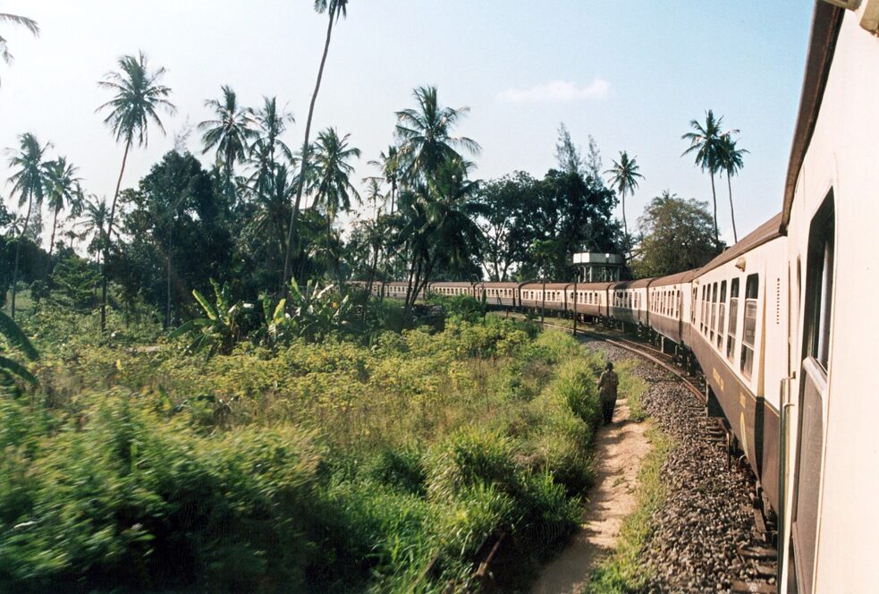
The undated archive picture shows the former Kenya-Uganda railway, which is now divided between the two countries. The rail network for the railway christened “Lunatic Express” by the colonial masters swallowed up more than five million British pounds until its completion in 1901, when 2,500 workers lost their lives. The Kenya-Uganda railway is one of the most impressive railway lines in the world. It begins at zero metres above sea level, runs through grassland and deserts, forests and highlands at 2,785 metres, only to drop back down from the equator to 1,520 metres. -
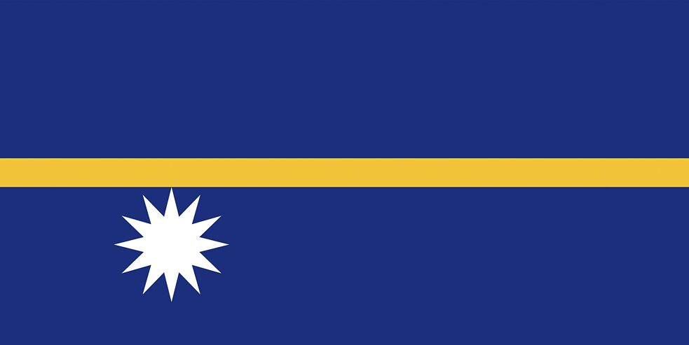
The flag of Nauru illustrates the geographical position of the island state only one degree south of the equator. Nauru is one of the smallest states in the world, consists of the coral island of the same name, which belongs to the island world of Micronesia, and lies in the Pacific Ocean. In 1888 Nauru was placed under the rule of the German Empire as a protectorate. During the First World War, Australia took control of the island and, apart from the Japanese occupation from 1942 to 1945, maintained it until the country became independent in 1968. -
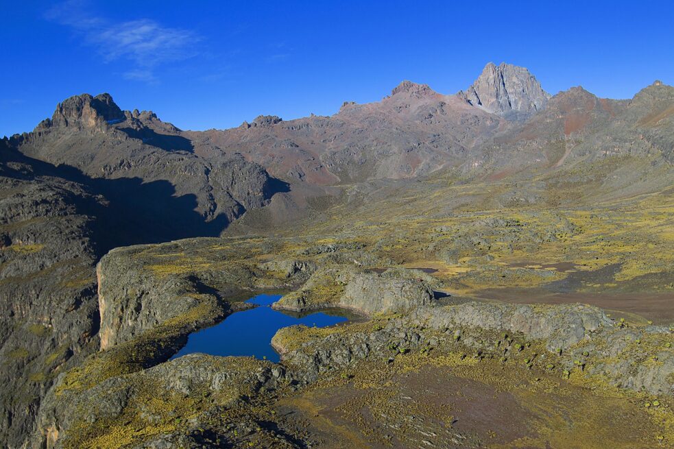
Mount Kenya in Kenya. It is the second highest mountain in East Africa and lies practically exactly on the equator. -
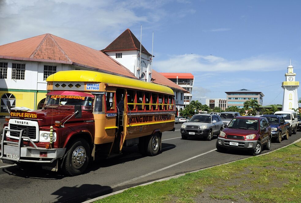
Rush hour in the center of Apia, Samoa. In the background on the right is the Clock Tower. The Clock Tower is one of the landmarks of Apia and commemorates the Samoans who died on the side of the Allies in World War I. The island state of Samoa is located in the South Pacific south of the equator not far from the International Date Line, belongs to Polynesia and experienced a long colonial period under the rule of various countries (United Kingdom, German Empire, United States of America, New Zealand) -
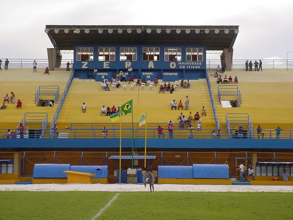
The undated photo shows the grandstand of the football stadium "Zerao" in Macapa, Brazil. The center line of the stadium runs on the equator, so one goal is in the northern hemisphere and the opposite one in the southern hemisphere.
Leave Comfort Zone
The first task of moving past colonialism is the completion of the work of dismantling and replacing the inequitable hierarchies that it has institutionalised. This transition from deconstruction to the creation of a new reality takes us to the alternative meaning of “latitude”and its association with the notion of freedom. In its most positive iteration, it speaks to imaginative explorations beyond the boundaries of the familiar. Part of the lived reality of the “post-colonial” era of many Global South nations is assimilation into, and normalisation of, the underlying logic of colonialism; ironically deepening the rot even as independence transformed the external façade into an apparently benign shadow. This is not to blame colonialism for everything that has gone wrong in these countries, rather it is to recognise the ways in which structural inequalities, hierarchies and hegemonies have morphed over time.Diversity of Lived Realities
Secondly, moving past colonialism entails interrogating limitations restricting thinking and acting, wherever or whoever we may be. Regardless of how these have been imposed and / or sustained, such limitations replicate colonialist logic, processes, institutional frameworks and privileges. Ironically, many protagonists who today embody the worst excesses of this colonialist order come from once-liberated spaces. Going past colonialism demands that we appreciate the rich, wide expanse of lived realities that preceded and extend beyond its narrow strictures. It means reacquainting ourselves with histories and collective memories that have been set aside, ignored, mis-represented or belittled.We must move away from practices that privilege even as they purpose the opposite, such as unnecessarily labelling histories or discourses as pre- or post- colonial.
“Going past colonialism demands that we appreciate the rich, wide expanse of lived realities that preceded and extend beyond its narrow strictures.”
Moving past colonialism entails a re-estimation of the colonial moment that acknowledges without over-emphasising its historical place and influence. This invites us to nuance what we know and how we know it; enabling an acceptance of realities and possibilities defying the simplistic dualities often inherent in the notion of “latitude”. We are pushed to know for ourselves, as opposed to ceding our right to think and act to others whose experiences, perceptions and understandings may not cohere with our own. In doing so, we discover the complexity of all that is beautiful and valuable in the world that is now, once again, our Point Zero.